Visibility: about 2 miles
Temperature: 19°C
Wind: 290°, 4kts
QNH: 1019hPa
Location: EDAY
Equipment: Cessna 152 (D-EMFM)
I have booked a small Cessna for this afternoon. The sky is grey, the ceiling is low. When I call the flight school around noon, they tell me to come later rather than sooner.
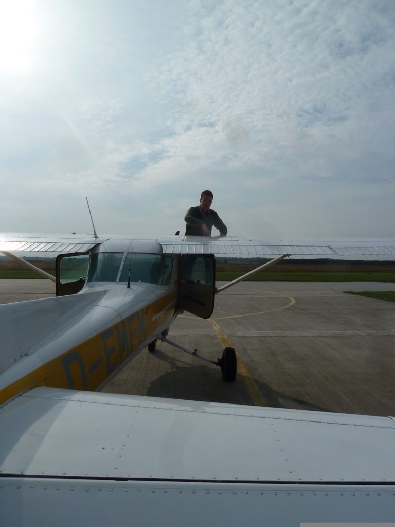
The airport is calm. A LSA is getting ready as I preflight my old friend „Fox Mike“. She is yellow and must have been pretty spiffy at some point. Memories of the Czech Republic and of the coast are connecting me with her.
The ceiling is very low today. But there is not a clear cloud base. The haze is just getting thicker with altitude. These are very dangerous conditions for VFR pilots. It is very easy to loose sight of the ground.
I climb out to the east and set course 080 direction EDON. The weather to the east is a bit better. After a few touch & go’s, I feel right at home with „Fox Mike“ again.
I don’t see much improvement. So I leave the pattern to the south and do some quick navigation training with the FWE VOR. Before long I have reached my way point and change my course back to EDAY.The GPS is on and I enjoy knowing it is there as a back-up. But I don’t need it.
Back at EDAY I see the runway when I am about 2 miles away. This is legal but on a day like today I would not feel comfortable flying somewhere new.
Winter is time for training. With low visibility and unpredictable weather, long trips in VFR are uncertain business. Staying on the ground is not an option, staying close to the airport is a compromise. I’m using the occasion for some navigation training. My plan today is a simple triangle to a near by VOR and back.
The air is cold and the plane is light. “Kilo Sierra” is eager to get of the ground.
The first leg is easy. I have dialed in the VORs frequency in the navigation radio. On the “Omni Bearing Indicator” (OBI), I turn the dial until the indicator needle moves into the center at around 140°. That is the course to the VOR.
The way is not very far and after about 15 minutes I am near the VOR. Directly over it, there is no reception. The NAV flag on the instrument comes up to indicate bad reception, so I know that I have reached the waypoint.
Now comes the second part. I turn the OBI to my new course, bank “Kilo Sierra” to the left and watch the directional giro turn slowly. The “to” flag on the OBI switches over to “from” and I am on my way. On this leg I don’t have a physical way point. I will request my bearing from the airport to determin the turning point.
I’m flying a triangle. From the airport I flew south-east to the VOR. From the VOR I’m flying north-east to my next way point. And from there I am planning to fly south-west, heading 230° for approach into runway 23. So my next turning point will be when my bearing to the airport is 230° (or a bit before as the airpane needs time to turn).
Todays flight is a training mission. I know the area and I have a pretty good idea of where I am. After the calculated time I see the town that is close to the mark on my map for the turning point. I start calling the airport “Delta Kilo Sierra, requesting QDM”.
“QDM” means the the magnetic heading from the aircraft to the airport. There are many “Q-codes”. Their origin is marine morse code, when brevity was key. The most common one for aviation is “QNH” which is the local atmospheric pressure calculated to mean sea level.
“270″ is the somewhat expected answer from the tower. I am 40° away from my desired course. After a few moments I ask again. “262″ is the instant reply. The radio operator at the airport has a large display for “QDM” and its counter part “QDR”, the magnetic heading from the station. With every transmission from an aircraft, the display lights up and shows the direction the aircraft is in. A very helpful tool for the small airport which does not have radar vectoring.
I am close to the airport so the degrees go fast. I decide to start my turn onto the desired course of 230°. When I am on course, I ask again for the “QDM” to confirm the heading. “226″, almost perfect.
Back on the ground I taxi to the apron and park “Kilo Sierra” next to another Cessna. An instructor I know is near by, his student is doing the pre flight. He smiles at me “I was wondering who it was requesting ‘QDM’ on a clear day like today”. I smile back “It was hard work trying not to see the airport from where I was”. The instructor looks at his student “Beautiful day for some navigation practice, don’t you think?”
To be continued…
(originally posted on March 13, 2014 by tilbo at aloft.blog.com/navigation-training/)
Visibility: not great, about 3k
Temperature: -2°C
Wind: 070°, 7 knots
QNH: 1020hPa
Location: EDAZ (Schönhagen)
Equipment: D-EKKS (Cessna 172N)
My new license has arrived more than a week ago and is still unused. The sky has been gray for weeks and I am ground-sick. Today the clouds are slightly higher and there is only moderate snow in the forecast for the afternoon. So I am off to the airport to see what is possible.
The target for the day is EDAZ, Schönhagen. It is a nice airfield south of the big city and about 40 minutes away from the home base. I do a quick flight plan-gestimation and am off. The visibility is not great, the ceiling is at about 2500 feet. There are patches of blue visible every now and again.
The radio beacon in Fürstenwalde (FWE VOR) is my waypoint. I fly on its radial 250° towards Schönhagen. The ground is snow covered. Lakes are frozen, from above it is difficult to tell them from meadows. Navigation by ground reference is very limited.
I use radial 305° of the KLF VOR as cross reference. The airport should be at the intersection of the two radials. EDAZ is located north of a little village and surrounded by forrest. I watch the needle of the second VOR slowly move to the middle and start looking for the airport. I have drifted a bit to the south but how bad can it be, really.
When I think I should see the airfield any minute now, I call in and announce my location, altitude and intention. Runway 07 is in use, there is not much going on on the Schönhagen frequency.
A few more moments pass and I still don’t have the airport in sight. The KLF needle is in the center now and the FWE needle is about 2 degrees to the right. Not a big deal as I want to enter the traffic pattern from the south anyway. I look ahead and to the right and I can only see gray sky and white ground. I turn a bit to the north and keep looking. I don’t want to accidentally get too close to the traffic pattern. I watch for a runway and wrestle down a slight feeling of uneasiness.
A few more minutes pass. The needle of the KLF VOR has moved out of the center again. I start thinking about options. What if I don’t find the airport?
I have fuel for about three hours – no problem here
Engine instruments are looking good – no reason to worry
I can simply fly back to the FWE VOR and go back home from there – safe exit strategy
I don’t have to pee – no need to hurry
Aviate, navigate, communicate
My situation is annoying and a bit embarrassing but not dangerous. I am at a safe altitude and I have enough fuel. So I start checking my map for a good point of reference. I did not take the approach chart with me and I start regretting the hasty flight planning already, when I see a city in front of me. The only larger city close to the airport is Luckenwalde, about 5 miles south. Could I be off my course by so much?
Recovery
I decide to follow the town to an intersection directly south of the airport and try to shoot straight up from there. I keep looking and before long I see the black of the runway through the mist. What a relieve!
I am one of only two guests at the airport restaurant in Schönhagen. I order a big glass of juice – my mouth is just a bit dry…
Incident investigation
Back home at my desk I try to figure out what went wrong. I start with my map. I gestimated a course of 250° from the FWE VOR to Schönhagen. The actual course should have been 252°, so that is a error of 2°.
Next I check the GPS log on CloudAhoy. From the VOR I flew a pretty straight line at first. Then, there is a slight change of course, about half way between the VOR and Schönhagen. Not much, maybe another 3° or 4°.
I am surprised to see how far this little deviation brought me from my course. How many miles does 5° translate to?
The distance from the VOR to Schönhagen is about 38 nautical miles. Remembering high school geometry, 2 x 38 miles gives me a circle of 239 miles. Divide that by 360 degrees and the distance per degree deviation in Schönhagen was about .66 NM.
So 5 lousy degrees – clearly within the margin of error of the junior aviator – translates into a miss of more than 3 nautical miles (3.5 statute miles or 5.5 kilometers)! Well beyond the visibility of the day.
Add the inaccuracy of the VOR indicator (the scale is analog and pretty approximate) and it becomes clear what has happened.
My Instructor smiles knowingly when I tell him the story. “Feels pretty bad if you can’t find the airport, doesn’t it?”
To be continued…
(originally posted on February 26, 2013 by tilbo at aloft.blog.com/o-airport-where-art-thou/)
It was map day at the flight school a few days ago. Every year the new aviation maps come out. After they are released, the old ones become void. The flight school usually has an order sheet for the new maps out and orders them collectively.
There are eight different maps for Germany. I ordered three – Berlin, Rostock (north of Berlin to the Baltic sea coast) and Hamburg (north west of Berlin with the North sea coast). So this is the area I’m planning to take on for this season.
To be continued…
(originally posted on June 9, 2011 by tilbo at aloft.blog.com/map-day/)


 x 38 miles gives me a circle of 239 miles. Divide that by 360 degrees and the distance per degree deviation in Schönhagen was about .66 NM.

