The second city is a little over an hour away as the Piper flies. They have a big international airport in the middle of the city. Not all of them are easily accessible to small aircraft. But this one has a good reputation in the general aviation community. Friendly and relatively easy to navigate. In fact I have been there by air once, many years ago with my flight instructor. I am qualified to go there, I am comfortable with the radio and I have current charts. How hard can it be, really! (Sounds like whistling in the dark? Maybe a little bit.)
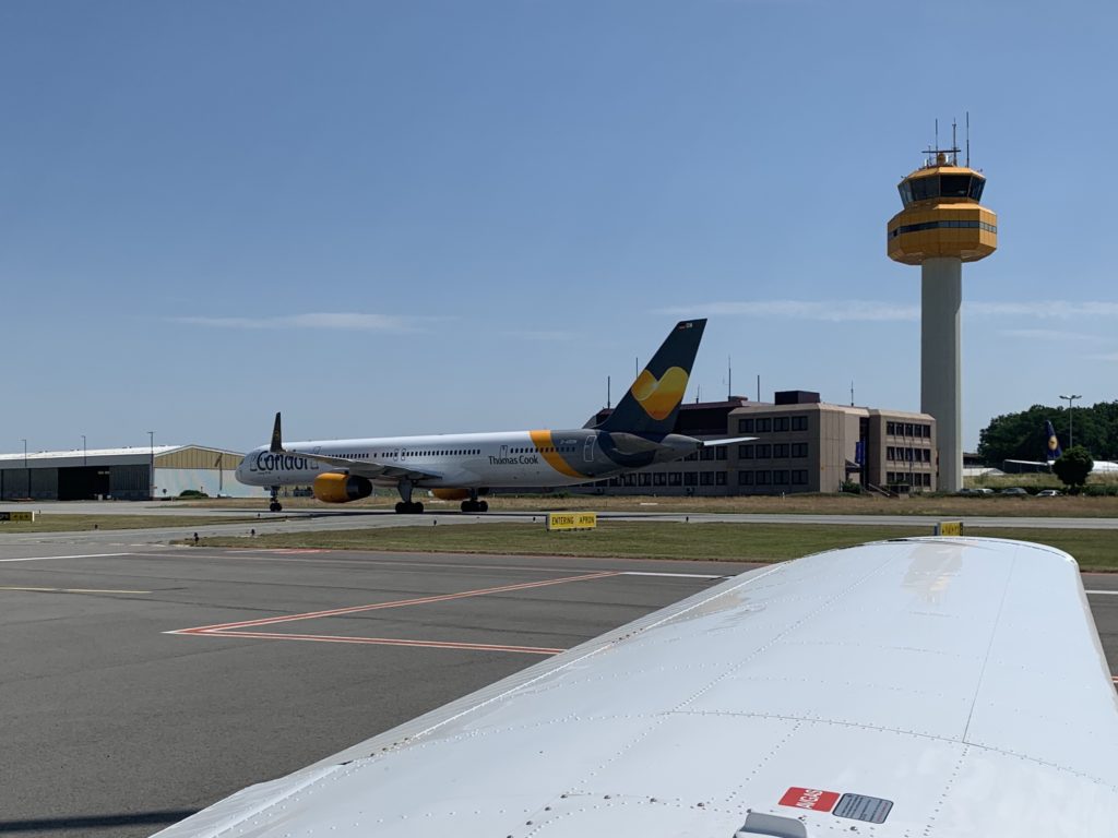
„Follow the Condor 757“
Big Jets International airports are the playgrounds of the pros. They fly the big iron, they do it all the time, they do it fast, and they sound cool on the radio. That can be a bit intimidating for piston scum like myself. But I’m on a mission. I want to visit my buddy before he moves away and I want to get there with as little ground contact as possible!
The day is gorgeous. I look over my flight plan and the approach briefing one more time, then I’m ready to go.
The flight is beautiful. I enjoy being in the sky again after spending a lot of time on the ground lately. The rain last night has washed the dusty heat away. The sun is out, the temperature is pleasant, not a cloud in the sky. When I get close to my destination, I listen to the ATIS, the automated broadcast about the current weather, runway in use and other important information at major airports. Then I call the tower.
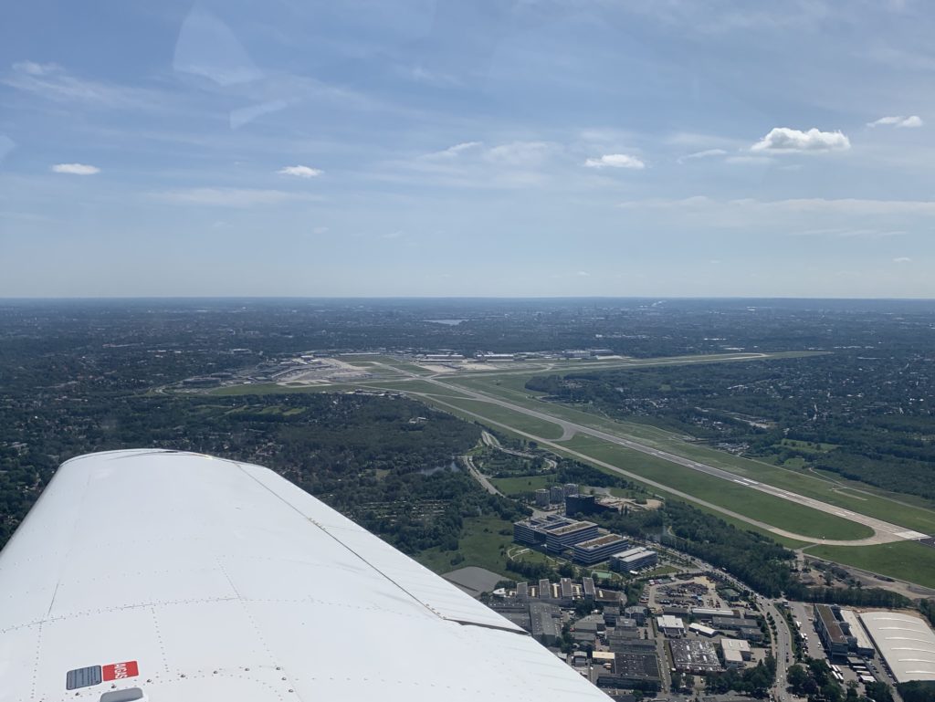
Controlled airspace I fly under Visual Flight Rule (VFR) and I typically move through the uncontrolled airspace. I can go where I want and although it is possible (and a good idea) to check in with air traffic control, I’m under no obligation to do so. The pros fly under Instrument Flight Rule (IFR). IFR traffic moves through controlled airspace, typically at higher altitudes. The big airports are the place where these two worlds meet. They have an area of controlled airspace around them in order to deal with the IFR traffic. When I want to enter, I ask the tower for permission and follow their instructions.
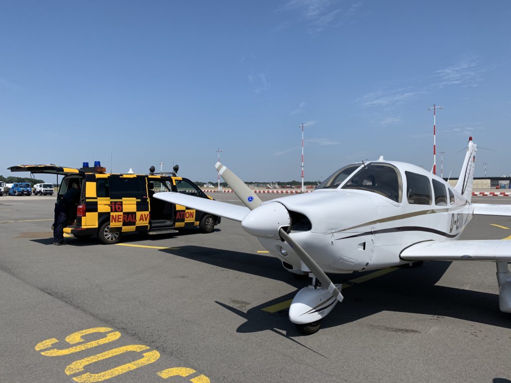
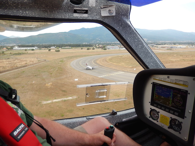
On a clear day like today, the approach is easy. The friendly controller vectors me to the correct end of the runway and tells me that I will be number two for landing after a CRJ regional jet. I report the traffic in sight and have enough time to watch him land before it is my turn. The runway is so big in all dimensions that I could probably land the little Piper sideways. When I taxi off of the runway, a follow-me car is already waiting for me. It guides me to my parking position, then the driver gets out and marshals me in with illuminated wands and a huge smile on his face. What a great welcome!
I feel like the king of the world and will probably come here again, soon!
To be continued…
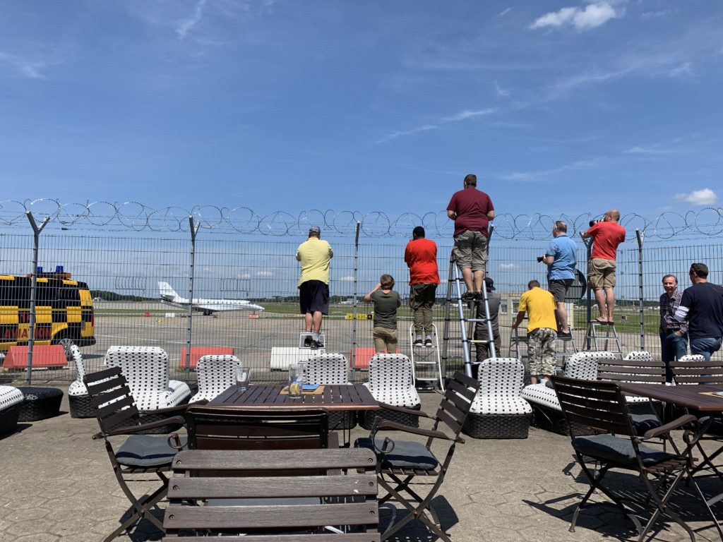
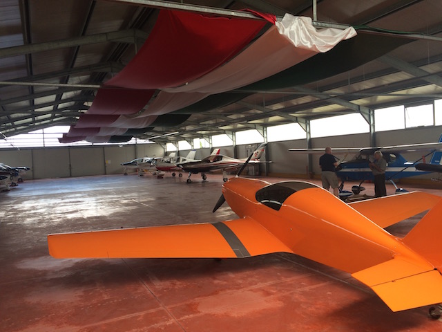
Follow MePlane spotters at the GA apron – not here to see me
My flying buddy calls: „Do you remember the Europe trip we planned last year? Are you still up for it?“ Me (wondering if he can hear my smile on the phone): „Sure! When?“ Him: „Two days from now, I’ll come pick you up!“
I had planned a few days off with the family. The pilots wife roles her eyes at me when she hears about this and then gives me that smile that touches my foolish heart.
The day before the trip I go through my preparations from last year. The route has changed a bit because we only have four days to spare. This trip will be about flying and about learning new routes and seeing new countries. There will not be time for sight seeing – the view from above is all we really need anyway.
We have ambitious plans! The first day is going to take us from The Big City to Millau in southern France. On the second day we plan to cross over the Mediterranean with a lunch break on the island of Corsica and on to Florence in Italy.
For the third day we plan to cross the Alps and fly back home. Sunday will be our extra day for bad weather or nice places that invite to stay.
Thursday
I am at the airport early. I have packed light but I am sure that I will still bring things back unused. The doors of the small terminal building are open but the staff clearly does not expect anybody yet.
My ride is wheels down at 6:01 Zulu, one minute after the official opening time of the airport. We have no time to loose, there are a lot of miles in front of us. After raised eyebrows and well wishes in EDAY, we are off to EDGF, the home base of the Rocket Ship. It is on the way, makes a good fuel stop and we have a few more things to pack before the trip.
The Rocket Ship is a FlightDesign CT LSA. She is small but very capable, well equipped and she has a lot of helpful details. For example, the two luggage compartments aft of the cockpit which are big enough for our two backpacks, my headset bag, our two life vests for the Mediterranean crossing as well as two empty 20 liter fuel canisters in case we need to go to a gas station for refueling somewhere.
France
The goal for today is LFMC, Millau-Larzac in the south of France. We have a stop planned at Besançon, about half way. The Rocket Ship makes its way towards France. The clouds could be higher and the visibility could also be better. But there is nothing but improoving weather in the forecast and we are confident. Crossing the border is a non event. We are asked to contact a new controller on a different frequency but that is pretty much it.
The VFR maps of France look intimidating. There are a lot of restrictions. Neither one of us has been flying in France before but we have heard positive things about flying here.
The controller in charge of us is also handling some IFR traffic on the same frequency. Her English is flawless and full of routine and we only have problems understanding her when she talks about waypoints that we are not familiar with. The Jeppeson Navigation software on the trusted iPad is warning us of one restricted area after the other and the controller clears us for all of them. We only have to deviate from our course to go around the airport of Lyon.
Before we know it, it is time to plan the approach into our half way stop in Besançon. Both of us are surprised about how quickly time passes. So we decide to skip the stop and continue on to Millau. There are plenty other airports on the way in case we should need a break after all.
We reach the Causse du Larzac in the golden light of the mid afternoon. The scenery of the plateau is spectacular. The airport comes in sight and there is no traffic and no controller on the frequency. We state our intentions and land with a strong, warm head wind on the long runway. Both of us need a moment before we have a full grasp of the day.
We spend the evening with friends and fresh sea food on a terrace overlooking the city of Millau. In the evening sun, para gliders are pirouetting over the hills across the valley.
Friday
We use our fuel canisters for the first time to fill the Rocket Ship up. The miracle of technology lets us file the flight plan online before we take off. After departure we contact Montpellier information and ask for our flight plan to be opened. Then we enjoy the spectacular scenery and speculate whether or not the glittering on the horizon is the Mediterranean already.
The rude awakening comes in the form of Camarque Information. Over Marseilles the friendly controller tells us in no uncertain terms that he has a problem with us. Our flight plan did not go through and we are not allowed to cross over to Corsica without one. So he tells us to find an airfield and land to file a proper plan for the trip.
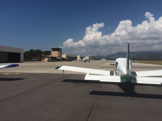
Le Castellet (LFMQ)
Le Castellet is on our way and proves to be our luck. Rarely have I been treated as friendly at an airport. We get coffee, a flight plan form and all the advice we could ask for in an air conditioned lounge with view of the smart looking Global Express.
The misunderstanding is cleared up quickly. Our flight plan made it to Touluse but we were probably in the air before it had time to make its way through the system. No problem, we file a new plan and thanks to the recent training at the AZF class, yours truly masters the task in no time.
Water
From Le Castellet we are routed to the St. Tropez VOR (STP) to start our crossing of the Mediterranean. There are a number of mandatory reporting points on the route so that no small plane gets lost. We venture out onto the open waters with a bit of a weird feeling. We have both not flown over open water before.
The engine does not quit; however, the trusted iPad does! Just before passing the first of the reporting points, the Jeppeson app shows a loss of GPS signal. Fortunately, the build in Garmin also knows the points. Finding them with compass and stop watch alone would have been a challenge!
Corsica
Long before we can see the island of Corsica, we see the thunderstorm that is drenching its hills. The clouds are towering high over the land mass.
The controller informs us that our destination of Corte reports rain and strong winds. We decide to try our luck anyway and see how it develops. Corte is located on the central plateau of the island and we are greeted with rain long before we are there. After some consultation with the controller, we decide on Bastia (LFKB) as alternate.
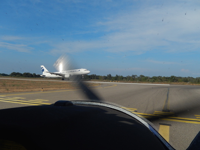
We did not plan on landing on a towered airport but the controller at Bastia is friendly and the airfield by the sea is in the sunshine. We are number two for landing behind a commuter twin and have a difficult time loosing altitude fast enough. The last mountain we cross is about 4,000 feet high, the threshold at Bastia is at 26 feet and not far away.
The service in Bastia is friendly but the staff is clearly more accustomed to airliners than to piston scum like us. Our handling agent is young, speaks Excellent english and is breathtakingly clueless in a very charming way.
I file our flight plan to Italy with him and when we are ready to go, the tower does not have it. A few moments later, our friend comes driving back out to us to retrieve the flight plan form from me. He needs it again as there has been a technical problem with the transmission. I don’t say anything but suspect the way the paper was facing in the fax machine as root cause of his ‚technical problem‘. We leave with a warm feeling for him in our hearts.
Italy
Bastia is on the eastern coast of Corsica and it does not take long before the island of Elba comes into view. The controller of Roma information does not seem all that interested in us. We both are happy when it is time to switch over to Firenze approach. The controller there is familiar with our destination aerodrome of Collina and double checks if we are, too. It will take a landing on the wrong field before we understand his concern.
On the northern border of the Firenze control zone, we cross a mountain range and then descend into a valley on approach to Aviosuperficie Collina. At the GPS coordinates from the webpage, we circle and look for the runway – but nothing. After a few minutes we see a field that looks promising. A low pass confirms our hopes, an airstrip with runway markers. So we fly a small pattern, radio our intentions and land. Italy at last!
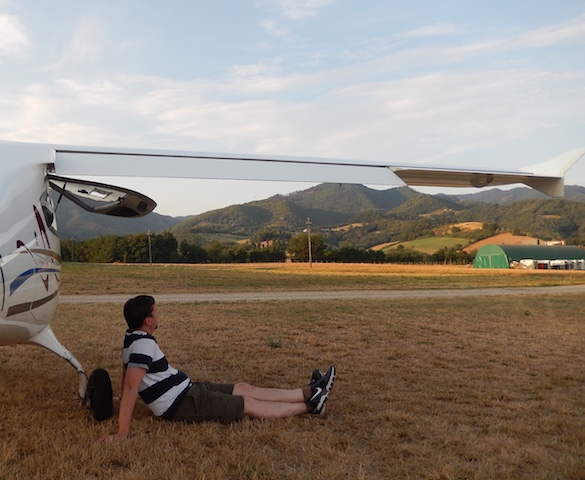
We are on the ground safely but it does not take long before our sneaking suspicion becomes certitude – this is not Collina. A farmer tells us that Collina is only a few miles away to the west. Hard to miss as it is right next to a racing track. So we are off again and after maybe five minutes we arrive at our destination for tonight. And we are being expected. A dry spot for the Rocket Ship is prepared and the dinner table is set. The warm welcome extends into a delicious meal and good company.
The next morning begins relaxed for us. The weather is not great but a high pressure area is coming from the west. So we are not planning on leaving before noon. Time enough for a tour of the hangar and the exchange of some pilot stories.
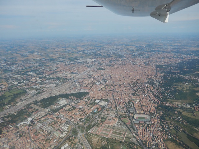
After a good Italian lunch, we feel ready. We leave Tuscany for the Emilia-Romagna region. The city of Bologna is in the sun and we can cross midfield over the airport.
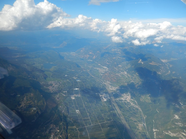
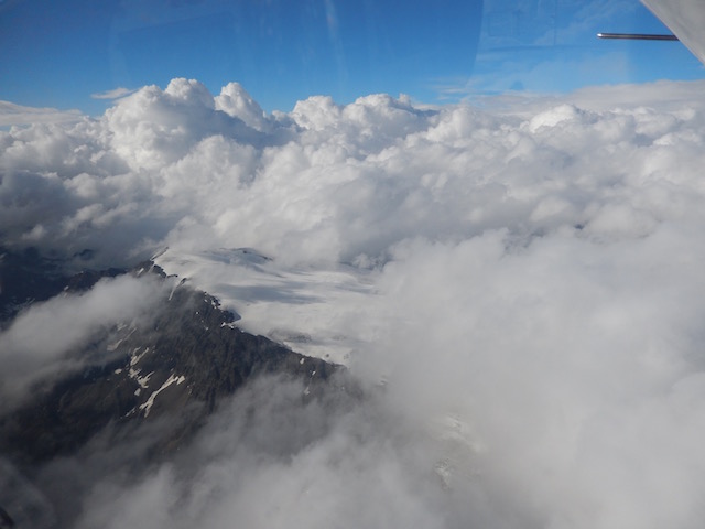
The Alps are coming closer fast, so we start climbing while we are still over Bologna. The next controller wants us to go via the Bolzano VOR. That is actually a bit further east that we would like to be but we go with that routing for now.
The clouds are towering high but they are clearly defined. In between them, the air is clear and the visibility is good.
We pass Bolzano to the west and go on north towards Merano on the lookout for a pass that is clear. We are high enough so that terrain is not a problem. To keep it that way, I am busy checking position, our flight level as well as the minimum safe altitude. My flying buddy is navigating around the puffy towers and looking out for a clear path.
As a team, we are safe. Alone I can see how a pilot could loose track of one or more of these factors.
The atmosphere between the clouds is very special. The sun gives the perfectly white barriers a stunning glow. My four-year-old has asked me before if one could land a plane on the clouds. I told him no but looking at them now, I am not so sure anymore.
With all of their beauty, we don’t forget for a moment how dangerous clouds can be to the untrained pilot. I did some basic training in flying after the instruments and I know how hard it is to keep the aircraft straight and level if you don’t see the horizon any more.
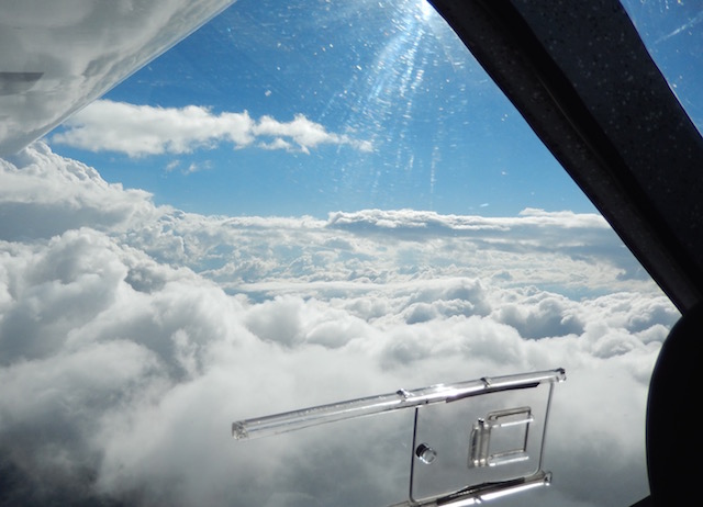
After a few circles, we realize that there is not going to be a clear path for us to sneak through. We finally turn west and see how far that high pressure area from the forecast has come. That’s okay, it was worth a try.
It’s not long before we call the Austrian controller. He is upbeat and friendly and does not seem very busy.
We finally meet the high pressure zone around St. Anton. As we turn north, the controller is very interested in the exact weather conditions. We can see the high pressure pushing the clouds. To the east, they are towering high over us, to the west, everything is clear. We are on our way home.
We are flying north over a patchy layer of clouds. The controller lets us stay up here so we enjoy the sun for a bit longer. We have done it; we have crossed the Alps!
Home stretch
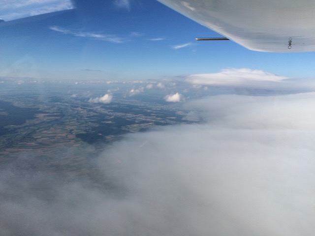
North of Kempten, the cloud cover ends and looking ahead feels like looking over the edge of a table. We descend further and Italy and the Alps feel like a distant dream. This region used to be my flying buddies home, he knows every tree and every runway. Our thoughts start drifting off. We did it, what a trip!
After a bit, my focus comes back to the plane and our fuel. The search for the hole on the clouds took quite some time. We have a pretty strong head wind now and the „Time Remaining“ on the fuel computer and the „Time to Destination“ on the GPS start getting uncomfortably close to each other. So we decide for a fuel stop after all.
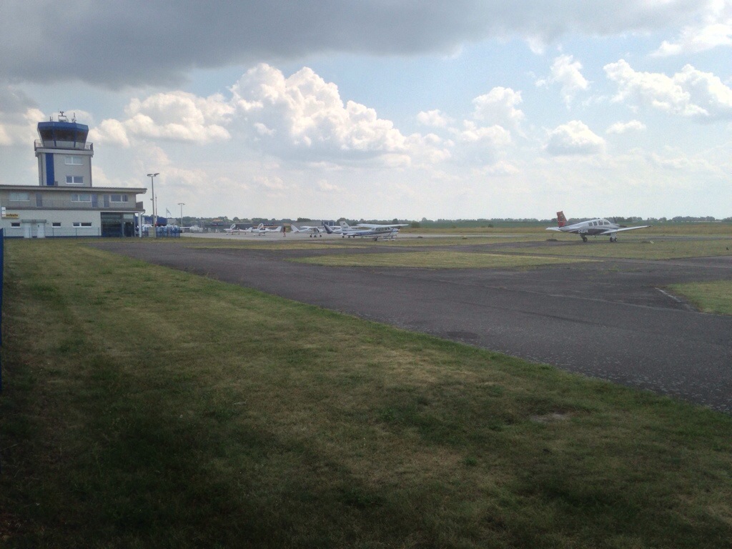
We get into EDGF just before it starts to rain. We move the Rocket Ship into the hangar and go to the hotel where a cold beer, a hot shower and a soft bed are waiting for us.
Close to 3,000 kilometers, more than 20 hours in the air, eight legs in four days, three countries, many smiling faces and a wealth of experience. I can’t wait for the next trip!
Visibility: CAVOK, more than 10k Temperature: 29°C Wind: 350°, 5 knots QNH: 1022hPa Location: EDAY Equipment: D-MALJ (Rider MD3)
I am excited. Airplanes in the stomach and all. I know the route very well but I have not travelled it in almost a year.
The flight bag is next to me. I packed it last night. Took the license and log book, checked the batteries in the head set and threw out the old map. It has been outdated for a while.
I walk the short stretch from the train station over to the airport. A glider is soaring in big circles towards an impressive tower of cumulus. Coming closer, I count at least three airplanes in the pattern. The gorgeous weather seems to make for a busy morning.
I took a bit of a baby break and am so ground sick that it hurts. But this morning will tell if I still have what it takes.
I’m at the big flight school first for a coffee and a chat. I need to fly at least 12 hours until next February to stay current. Challenge accepted!
Next stop is the LSA flight school. I can not drink more coffee and I’m getting antsy. So as soon as the instructor and student come through the door, I am out to take possession of the aircraft. My old love „Lima Juliet“ will be the ship today. We go way back together. I passed my very first check ride with her, took her to the island of Rügen and impressed my friends with her.
Old friend
„Lima Juliet“ is comfortable like an old pair of shoes. I was a bit worried but we get along just fine. She is light and the thermal up draft from the fields is playing with her even at 2.000 feet.
We go over to Eggersdorf for some pattern work. My landings are very acceptable and I am glad. I try different flap settings and approaches and the landings are pretty consistent. Not all greasers, non real bad ones either. Glad to be back!
Visibility: CAVOC, more than 10k
Temperature: 23°C
Wind: 140°, 6 knots
QNH: 1028hPa
Location: EDFE (Egelsbach)
Equipment: D-EFRV Cessna 172P
There is a lot of moisture in the early morning air but the sun is bright and the day promises to be nice. I am on my way to EDFE, Egelsbach. The airfield is one of the busiest for general aviation in the country. What makes it more demanding than others is its proximity to the very busy Frankfurt International Airport and the fact that corporate jets and piston single trainers co-exist here.
I’m in the area for a few days and decide to take an introductory flight with a local flight instructor. Who knows, I might come back here by air some day and a head start can’t hurt. It has been since the fall that I last flew a 172. But when I sit down I feel right at home. The instructor goes through the check list with me, we start up and go. The airport is not hugh but even this early it is buzzing with activity. There is even a seperate radio frequency for the ground traffic. I have never seen that at an uncontrolled airfield.
A smart looking black citation jet is starting up next to us. It is right behind us on taxiway Alpha to runway 09. The controller asks us if we can take the last but one ramp onto the runway (Foxtrot) and let the much faster jet pass and take-off before us. We are more than happy to comply and enjoy the front row view of the sleek beauty roaring past us and taking to the skies.
Cap at 1.500 feet
The traffic pattern at Egelsbach is in a relatively small box of airspace that is cut out of the controlled airspace of Frankfurt International Airport. The approach is routed through a set of compulsory reporting points and the maximum altitude is a mere 1.500 feet. The field itself is at 385 feet, so there is not a lot of safety margin over a woody area with hills rising to the south. It feels tight in a Cessna and I have to salute the jet pilots making this approach.
We leave the Egelsbach-box via Echo, turn south-west to pass Kilo and approach again via Delta 1 & 2. The base leg into runway 09 is very close to the controlled airspace and the instructor makes very sure we do not penetrate it.
We repeat the exercise a few more times until I start feeling comfortable. It was a good idea to do this with a local instructor and I am looking forward to my next visit – flying!
To be continued…
(originally posted on July 19, 2013 by tilbo at aloft.blog.com/flying-with-the-jets/)
Ferry pilots are the toughest breed of pilots. They master weather and distances in small aircraft with nothing but experience and intuition to guide them. Other pilots pay for their drinks just to sit with them and hear stories of marginal conditions over the north Atlantic, finding Cessna spare parts on a jungle airfield in the hinterlands of Brazil or bribing corrupt customs officials in Sub-Saharan Africa.
Today I join the ranks of this pilot elite. I will fly my first ferry flight, on my own, only man and machine. The route is not quite the north Atlantic crossing and I will not need additional ferry tanks. But every hero has to start somewhere.
My flying buddies rocket ship “Kilot Tango” has been at the maintenance shop for the annual inspection. He asked me to pick it up for him and fly it south to his work place. He gets the aircraft back, I get to fly for free!
The day starts with a train trip. I bought a folding bike and have yet to test its usefulness and see if it will actually fit into the aircraft. The airport is about 4 miles away from the train station, a good distance for a first test. It folds open quickly and the luggage is strapped securely onto it. Looks promising – and just a bit geeky. The morning is warm, the bike is single speed and I am happy that I picked a short distance for the test.
“Kilo Tango” is waiting for me at the airport already. The friendly technician walks me through the list of the maintenance items that they performed. Then comes the moment of truth: Will the bike fit on the passenger seat?
30 knots of head wind
The day is windy and the strong head wind that almost catapults Kilo Tango off the ground on take-off, will stay on the nose for the flight. The first part of the trip takes me on the scenic tour right over the Big City and through the controlled airspace of the international airport.
After I leave this crowded area behind, I try different altitudes to see if I find a layer with more favorable winds. Puffy white clouds are sunning themselves on a bed of blue. And I get to play with them up here! Unfortunately the head winds are consistent, I do not find a layer with less than 30 knots on the nose. I swear I see the time to destination counter on the GPS go up not down. But I took enough fuel and I brought music. So the spirits are high.
After a long flight, I wish the friendly controller a good evening and descend into the green hills below. Finding an airport can be difficult. The airport I am looking for is a hardly marked grass strip in the middle of fields. From above, the hangar building looks just like another barn. With the GPS I need two circles before I spot it. Without it, I’m not sure I would have found it at all.
The way home is by train again. The bike is folded up in the baggage compartment and while I have dinner, I look up at the clouds.
To be continued…
(originally posted on June 22, 2013 by tilbo at aloft.blog.com/ferry-flight/)
I read several magazines about aviation on a more or less regular basis. But there is one that I never miss an issue of: “Pilot und Flugzeug“. The magazine itself is in a small format and does not look as glossy as some. But the content is the best I have seen. A lot of it is over my head but I am inspired by it every month.
The other great thing about “Pilot und Flugzeug” is the fact that they operate three aircraft. Two are single engine four seaters and one is a pressurized turbine twin. And all of them are available for readers to use!
Today I will be checked out on “Lisa Berlin”. She is a Grumman AA-5A “Cheetah”. LISA is a light four seater, not unlike the Cessna 172 I have been flying. But her low wing configuration gives her a sleek look compared to the trusted but bulky Cessna. I have read the flight manual, passed a small online check-out, mailed copies of my license and the rental agreement to the publisher and today I get to meet LISA in person.
LISA is stationed at Schönhagen. A busy and well organized airfield south of the big city. I am early and a friendly clerk hands me log book and the keys. I have time for a walk around on my own.
When the friendly instructor arrives, we start with some formalities and ground school. Then follows the briefing in the aircraft. LISA was born in the 70s but has been equipped with modern avionics, including a Bendix KFD 840 “Primary Flight Display”. This integrated flight instrument requires some training before it is mastered.
Off we go
I’m ready for some action and so is LISA. The steering on the ground is done by differential breaking which requires practice. We take off and fly out of the pattern to do air work. As a low wing aircraft, LISA has a higher roll rate than the high wing Cessna, the climb qualities are similar.
We do a few turns, stalls, slow flight with flaps and without, and a basic introduction to the auto pilot. I like the little cat right away. She feels lighter on the controls than the Cessna and is still more stable than the agile but nervous Light Sport class.
After about half an hour of air work, we turn back to the airport for some landings. On to the next challenge!
Ground effect
I have almost no experience with low wing aircraft. Close to the ground, the flow of air under the wings can build up so that the aircraft “floats” on this waive. This “ground effect” is a much bigger factor in low wing aircraft, as the wings are much closer to the ground.
The instructor has told me to not worry too much and just cut the power a bit earlyer that I usually would. So I bring the engine to idle, flare and grease her to the ground. The stall horn chimes (as it should) and LISA sits down in the middle of the touch down zone. Wow, that was easy!
Beginners luck – the next two approaches are a bit bumpier. But all in all LISA handles well on approach and lands easily.
After an hour the instructor has seen enough. He signs my log book and I am officially qualified to fly PIC in the Grumman AA-5A. EDAZ has a nice restaurant with a terrace overlooking the apron. This is where I conclude the flying day with a large beverage on the table in front of me. I can’t wait for the next time I see LISA!
To be continued…
(originally posted on May 8, 2013 by tilbo at aloft.blog.com/meet-lisa/)
Visibility: Clear in the north, less so in the south
Temperature: 15°C
Wind: 270°, 2 knots
QNH: 1015hPa
Location: Finow (EDAV)
Equipment: D-MAKT (FlightDesign CTLS)
My flying buddy has a day job. Part of that is aerial documentation of pipelines. On occasion I will go on a job with him. He gets to take better shots, I get to fly for free.
Todays construction site is more than two flight hours away. There is a mountain range about half way there and we are not sure if the weather on the other side is going to be good enough. So we make a quick stop for fuel and a weather update at one of the mountain airfields.
The spring sun has started to lift the clouds and burn-off the mist on the other side of the mountains. So we fuel-up and venture forward. The route of the pipeline plays with a highway, a train line and a river, all competing for space in the narrow valley.
We set flaps and trim the aircraft for slow speed. Then we sink to the legal limit into the valley. He opens the photo window and I follow the windy path of the pipeline as slowly as possible, always looking ahead for raising terrain. After a few moments I get used to the strange sensation and “Kilo Tango” almost feels like a helicopter.
After about half an hour we are done and the memory cards of the camera are full with the days work. We turn towards home and through a large hole, we climb above the clouds. The sun is bright and powerful up here and the air is smooth. On the way home we might even get a tan!
My friend has a long night of driving ahead of him. So he just jumps out and I take “Kilo Tango” to bed. She is stationed at an old military airfield now. The hangars were constructed as bunkers for the fighter jets of the cold war area. Now they are the safest space imaginable for a peace time photo ship.
To be continued…
(originally posted on April 30, 2013 by tilbo at aloft.blog.com/pipeline-flying/)
Visibility: CAVOC, more than 10k
Temperature: 2°C
Wind: 240°, 4 knots
QNH: 1022hPa
Location: Crussow
Equipment: D-MAKT (FlightDesign CTLS)
My flying buddy calls to tease me (“Just wanted you to know that the bird is out of the hangar”). The sky is blue and the sun is shining for the first time in weeks – and I have to work.
But there is flexibility in my job and I can swap with a colleague. The morning is mine, the roads are empty and the Bavarian straight six accommodates my eagerness to get to the airport.
I have not flown “Kilo Tango” since the fall. I am pretty rusty with her. So we plan to start the day with a bit of pattern work. After the first take-off however, she climbes out of the small pattern like a homesick angel*. So I reconsider and do some air work to loosen up.
After a bit of that, we approach the runway for a touch-and-go. The FlightDesign CT is aerodynamically very clean. She excelerates and climbes fast and it requires conciderable effort to slow her down. After pulling back the throttle, she keeps going for a long time. A big adjustment from the Cessnas I have been flying over the winter. Pulling the throttle on the 172 feels like throwing an anchor in comparison.
It takes six approaches before I have three decent touch-and-goes. I have to learn to be more ahead of the aircraft, plan the approch and fly very exact speeds and altitudes. There is not a lot of cheating possible.
Time for some flying
We climb to 4.000 feet and set course for an airfield we both have not been to. The sun warms our faces and the view is gorgeous. The snow on the fields has melted but most of the lakes are still frozen.
The air up here is smooth and I have time to get deeper into the glass cockpit. I read the manual of the Dynon D100 and D120 EFIS but it takes practice to make use of all the functions and information available.
What was science fiction 20 years ago can now be found in the cockpit of a light sport aircraft. On the main screen, I get attitude, altitude and speed at a glance together with the trends. Actual heading and planned course are displayed as well as the engine instruments. In addition to that I get wind direction and speed, angle of attack and outside air temperature. We live in great times.
On the way back we have kind of a quiet moment. A beautyful day, a great aircraft, a good friend and the freedom to just go and fly. What a sweet day!
Visibility: not great, about 3k
Temperature: -2°C
Wind: 070°, 7 knots
QNH: 1020hPa
Location: EDAZ (Schönhagen)
Equipment: D-EKKS (Cessna 172N)
My new license has arrived more than a week ago and is still unused. The sky has been gray for weeks and I am ground-sick. Today the clouds are slightly higher and there is only moderate snow in the forecast for the afternoon. So I am off to the airport to see what is possible.
The target for the day is EDAZ, Schönhagen. It is a nice airfield south of the big city and about 40 minutes away from the home base. I do a quick flight plan-gestimation and am off. The visibility is not great, the ceiling is at about 2500 feet. There are patches of blue visible every now and again.
The radio beacon in Fürstenwalde (FWE VOR) is my waypoint. I fly on its radial 250° towards Schönhagen. The ground is snow covered. Lakes are frozen, from above it is difficult to tell them from meadows. Navigation by ground reference is very limited.
I use radial 305° of the KLF VOR as cross reference. The airport should be at the intersection of the two radials. EDAZ is located north of a little village and surrounded by forrest. I watch the needle of the second VOR slowly move to the middle and start looking for the airport. I have drifted a bit to the south but how bad can it be, really.
When I think I should see the airfield any minute now, I call in and announce my location, altitude and intention. Runway 07 is in use, there is not much going on on the Schönhagen frequency.
A few more moments pass and I still don’t have the airport in sight. The KLF needle is in the center now and the FWE needle is about 2 degrees to the right. Not a big deal as I want to enter the traffic pattern from the south anyway. I look ahead and to the right and I can only see gray sky and white ground. I turn a bit to the north and keep looking. I don’t want to accidentally get too close to the traffic pattern. I watch for a runway and wrestle down a slight feeling of uneasiness.
A few more minutes pass. The needle of the KLF VOR has moved out of the center again. I start thinking about options. What if I don’t find the airport?
I have fuel for about three hours – no problem here
Engine instruments are looking good – no reason to worry
I can simply fly back to the FWE VOR and go back home from there – safe exit strategy
I don’t have to pee – no need to hurry
Aviate, navigate, communicate
My situation is annoying and a bit embarrassing but not dangerous. I am at a safe altitude and I have enough fuel. So I start checking my map for a good point of reference. I did not take the approach chart with me and I start regretting the hasty flight planning already, when I see a city in front of me. The only larger city close to the airport is Luckenwalde, about 5 miles south. Could I be off my course by so much?
Recovery
I decide to follow the town to an intersection directly south of the airport and try to shoot straight up from there. I keep looking and before long I see the black of the runway through the mist. What a relieve!
I am one of only two guests at the airport restaurant in Schönhagen. I order a big glass of juice – my mouth is just a bit dry…
Incident investigation
Back home at my desk I try to figure out what went wrong. I start with my map. I gestimated a course of 250° from the FWE VOR to Schönhagen. The actual course should have been 252°, so that is a error of 2°.
Next I check the GPS log on CloudAhoy. From the VOR I flew a pretty straight line at first. Then, there is a slight change of course, about half way between the VOR and Schönhagen. Not much, maybe another 3° or 4°.
I am surprised to see how far this little deviation brought me from my course. How many miles does 5° translate to?
The distance from the VOR to Schönhagen is about 38 nautical miles. Remembering high school geometry, 2 x 38 miles gives me a circle of 239 miles. Divide that by 360 degrees and the distance per degree deviation in Schönhagen was about .66 NM.
So 5 lousy degrees – clearly within the margin of error of the junior aviator – translates into a miss of more than 3 nautical miles (3.5 statute miles or 5.5 kilometers)! Well beyond the visibility of the day.
Add the inaccuracy of the VOR indicator (the scale is analog and pretty approximate) and it becomes clear what has happened.
My Instructor smiles knowingly when I tell him the story. “Feels pretty bad if you can’t find the airport, doesn’t it?”
To be continued…
(originally posted on February 26, 2013 by tilbo at aloft.blog.com/o-airport-where-art-thou/)
Visibility: about 5 kilometers
ceiling: inversion with clouds at about 3.000 feet
GAFOR: “C” clear skies!
Temperature: 18°C
Wind: 240, 20 knots
QNH: 1017hPa
Location: EDAY (Strausberg)
Equipment: “Foxtrot Mike” (Cessna 152)
One of the great things about being a pilot is the ability to go places. The term “day trip” gets a whole new meaning.
Sunday in late September. The morning is a bit hazy but promises to be nice. The kid is with the grand parents, the wife is with the pilot. The island of Usedom is the goal for the day. We will meet up with friends there who also travel by air.
The visibility is not great but we climb “on top”. Here, above the clouds, we enjoy the sun and the calm air.
Never trust the fuel gauge
On top
When we arrive, our friends are there already. We start talking about each others ride. His flying club’s Cessna 172 is from the 90s – practically new in general aviation terms.
There are bikes available at the airport and we ride to the near by town. Fish for lunch and chatting in the sun. Time flies and before we know it, the afternoon is over.
Climbing out of Peenemünde
On the way back, we climb to FL65. Visibility is still not great, especially as we are flying towards the sun now. But spirits are high and we enjoy the rest of our pick nick. Sure beats airline food.
Back at home
Back at home the sun is hanging low already. The shadows are long and the day on the beach comes to an end. We have some of the days fresh catch with us for dinner. A very nice conclusion to a very nice day.
To be continued…
(originally posted on September 17, 2012 by tilbo at aloft.blog.com/day-trip-to-the-beach/)


 x 38 miles gives me a circle of 239 miles. Divide that by 360 degrees and the distance per degree deviation in Schönhagen was about .66 NM.


